|
Images
Storm of 2003
Projects
|
Chapter 12: Tropical
Weather
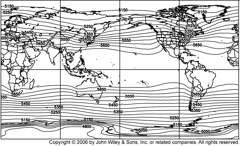
- Figure
12.1
1000 - 500 hPa thickness averaged over 1970 to 1999. NCEP Reanalysis
data provided by the NOAA-CIRES Climate Diagnostics Center, Boulder, Colorado, USA, from their Web site at http://www.cdc.noaa.gov/
- Figure
12.2
Equatorially trapped Kelvin wave shown as (a) a plan view and (b) a three
dimensional view. Vectors in (a) indicate zonal wind associated with the wave. Note that the pressure height surface and
zonal wind magnitude vary sinusoidally in x (longitude) and exponentially decay in y (latitude).
- Figure
12.3
The top panel shows the zonal mean zonal wind at the equator at an altitude
corresponding to the 30 hPa level, from 1955 to 2005, showing the quasi-biennial oscillation between easterlies (negative) and
westerlies (positive). An example of the westerly phase is shown in lower panel (1) during March 2002, and of the easterly phase
in lower panel (2) during July 2003: these panels show the zonal mean zonal wind by latitude and height. Westerlies are indicated
by solid contours and easterlies by dashed contours. Reanalysis data provided by the NOAA-CIRES Climate Diagnostics Center,
Boulder, Colorado, USA, from their Web site at http://www.cdc.noaa.gov/
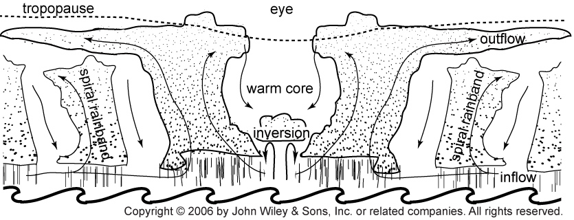
- Figure
12.4(a)
Cross-section through a mature tropical cyclone, showing the main features
and the vertical circulation.
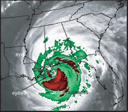
- Figure
12.4(b): Hurricane Ivan
Key features of a mature tropical cyclone, as shown on an enhanced
infrared satellite image of Hurricane Ivan, taken at 0315 UTC on 16th September 2004. Image courtesy of the NOAA National
Severe Storms Laboratory, Norman, Oklahoma, USA.
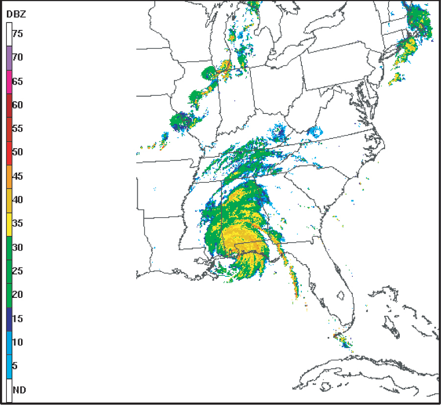
- Figure
12.4(c)
A radar image of Hurricane Ivan taken 0703 UTC on 16th September 2004.
Image courtesy of the NOAA National Severe Storms Laboratory, Norman, Oklahoma, USA.
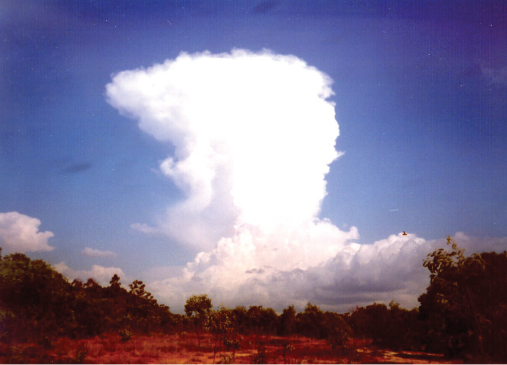
- Photo:
Tropical Cyclone Hector
Photo of Tropical Cyclone Hector developing. The photograph was taken on
15 October 2001 at Pirlangimpi (also know as Garden Point) on Melville Island in the north of Australia by A. Marshall.
|
Toolbox
CD Home
|